One of the most innovative approaches from the CGIAR Research Program on Forests, Trees and Agroforestry (FTA) is the establishment of a set of ‘sentinel landscapes’.
These have formed part of a global analysis of networks and helped to understand issues and processes relevant to ecosystems worldwide.
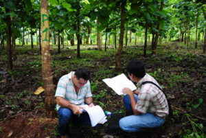
A sentinel landscape is a geographic area or set of areas bound by a common issue, in which a broad range of biophysical, social, economic and political data are monitored, collected with consistent methods and interpreted over the long term.
CATIE (Tropical Agricultural Research and Higher Education Center), in conjunction with FTA, has coordinated a Sentinel Landscapes initiative since 2012. The long-term data are essential for addressing development, resource sustainability and scientific challenges, such as linking biophysical processes to human reactions and understanding the impacts of those reactions on ecosystems.
CATIE – a regional center dedicated to research and graduate education in agriculture, and the management, conservation and sustainable use of natural resources, and a strategic partner of FTA – recently held four workshops for 164 participants from 45 organizations representing government, academic, productive sectors and NGOs.
The workshops, held on Nov. 5, 7, 9 and 27, 2018, focused on presenting the results and advances of the Nicaragua-Honduras Sentinel Landscape initiative and were held in the cities of Matagalpa and Siuna in Nicaragua and Catacamas and La Ceiba in Honduras. The Nicaragua Honduras Sentinel Landscape is characterized by a variety of land uses. Tree cover is therefore diverse, competition for land is high, and speculation and renting land are common, but these arrangements drive deforestation, hinder long-term investments and exacerbate land degradation.
Watch: Analysis and monitoring of deforestation dynamics in FTA sentinel landscapes
The gatherings aimed to provide a space for the exchange of information between decisionmakers and key actors in the sectors of environmental management, forest management, protected areas, livestock, cocoa, coffee and biodiversity.
Around 64 participants from 45 organizations representing government, academic, and production sectors as well as some NGOs updated their knowledge of the Sentinel Landscapes initiative, exchanging information on their projects and activities, which served to improve levels of coordination among participating organizations.

Since the initiative began, CATIE students have conducted valuable thesis studies that have contributed to improving knowledge and research methodology in the sentinel landscape.
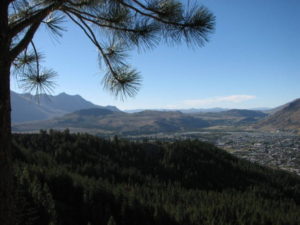
The Nicaragua-Honduras Sentinel Landscape is a mosaic of forests, agricultural lands, cattle ranches and agroforestry systems, covering 68,000 square kilometers, including two biosphere reserves and 13 protected areas.
“This landscape also contains the largest forest area in Central America,” said Norvin Sepúlveda, CATIE’s representative in Nicaragua.
Watch: CIFOR’s Robert Nasi on Sentinel Landscapes
The initiative develops and implements a standardized matrix that includes a set of indicators and livelihoods to monitor landscape sustainability in a wide variety of cultural, institutional and environmental settings.
Sepulveda also indicated that socioeconomic and biophysical baselines have been developed in conjunction with universities and local organizations.
José Manuel González, CATIE representative in Honduras, mentioned that it is important to make these databases available to organizations, to continue with studies and monitoring, as well as to strengthen local and national alliances.
In this sense, Alan Bolt, coordinator of the Collaborative Management Committee for the Peñas Blancas Protected Area and director of the Center for Understanding Nature, stated that CATIE’s support, through the initiative, had been important for the institutionalization of the committee and the thesis studies carried out by students have improved research methodology.
Indeed, sentinel landscapes can provide a common observation ground where reliable data from the biophysical and social sciences can be tracked simultaneously and over time so that long-term trends can be detected, and society can make mitigation, adaptation and best-bet choices.
By Priscilla Brenes Angulo, CATIE Communication Assistant, first published by CATIE.
For more information, contact Norvin Sepúlveda, nsepulveda@catie.ac.cr.


