Getting behind the camera enables farmers to express their perspectives and assess their land in a creative and engaging way.
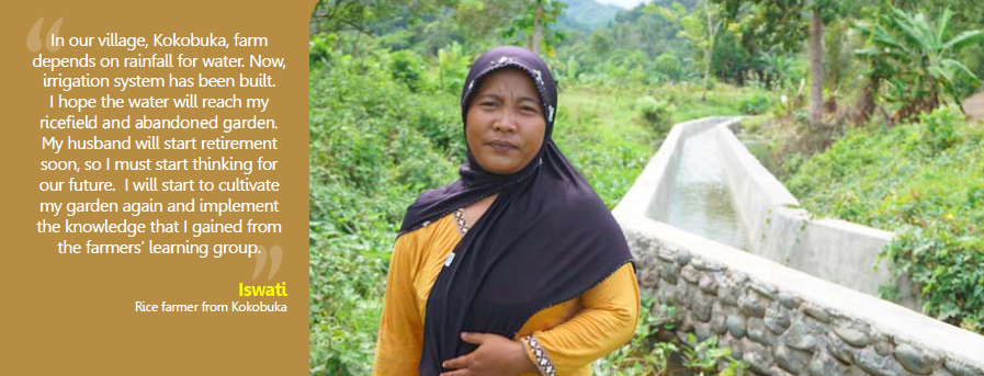 The Climate-smart, Tree-based Co-investment in Adaptation and Mitigation in Asia (Smart Tree-Invest) project focused on improving the livelihoods and resilience of smallholder farmers through the promotion of climate-smart, tree-based agriculture in three countries by reducing their vulnerability to climate change.
The World Agroforestry Centre (ICRAF) project, supported by the CGIAR Research Program on Forests, Trees and Agroforestry (FTA) and the International Fund for Agricultural Development (IFAD), recently completed its three-year journey.
Among the most innovative aspects of the project was Photovoice, a participatory research method that saw cameras provided to farmers in the project’s field sites.
Read more: Smart use of trees: Co-investment scheme improves livelihoods, maintains ecosystem services
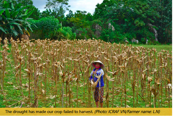 “The main objective was to help in identifying and understanding the vulnerability and adaptive capacities of smallholder farmers to climate change and variability in Ho Ho-subwatershed as a project site, through photos that reflect local perceptions and knowledge on vulnerability,” said Tran Ha My, communications staff member for Smart Tree-Invest in Vietnam.
“Photovoice is also a different approach to share farmers’ insights and experiences, which helped the project and local stakeholders to develop more appropriate solutions for enhancing livelihood and environmental resilience in the subwatershed,” she added.
The benefits of the approach were twofold. The farmers had a creative way to express their perspectives, could better understand their vulnerabilities and capacities and more actively participated in discussing issues related to their land. Meanwhile, the researchers also collected baseline photographs of the landscape in the process.
See the baseline photographs for Buol in Indonesia, Huong Lam in Vietnam and three sites in the Philippines.
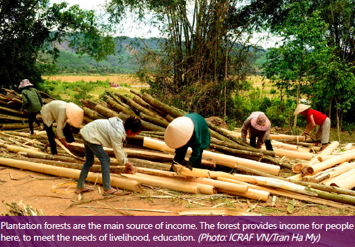 “Using photos in focus groups and a video baseline survey puts faces to the once-anonymous ‘stakeholders’ of a project. They give a more personal dimension to all the figures and statistics and help show what farmers really need and how researchers can help,” Amy Cruz, communications staff member for ICRAF in the Philippines, wrote early in the life of the project.
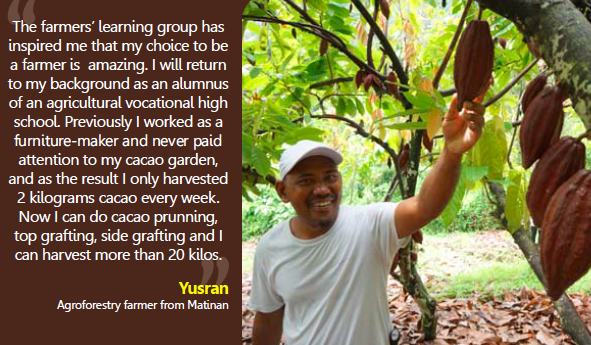
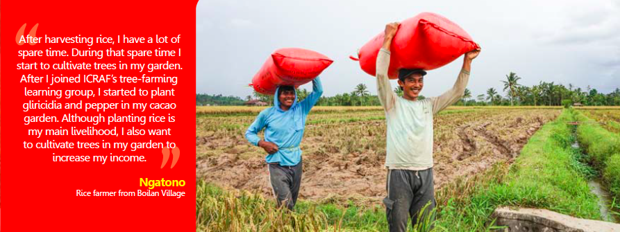
The personal dimension was clear in the results, which showed smallholders’ land through their own eyes. Later, impact photos displayed improvements in the farmers’ livelihoods through knowledge gained from the project.
“Photovoice is a process that allows more nuanced capturing of the important elements in a landscape by letting farmers themselves decide specific areas to photograph. We asked them to capture two of their areas that were most vulnerable to climate change, two of their resources and two of their coping strategies. Aside from documentation of the landscape and the farmers’ perspectives, the photos were used in discussion groups to further draw out opinions of the landscapes in their respective villages,” Cruz explained.
 “Nearly all the farmers identified sloping areas on their farms as the most vulnerable — they were usually flooded during rains — and the crops as their resources. There was, however, a variety of coping strategies mentioned by the farmers when discussing the photographs.
“Some said they did not do anything when the land flooded; they just waited for the waters to recede. Others said that they did, or planned to, use contouring on their fields to counter erosion. Quite a few also used trees as boundaries and windbreaks,” she added.
See the impact photos from Indonesia and Vietnam.
The photographic results were used in focus group discussions with participants and with other farmers who did not take photos themselves. Through conversations over the results, the farmers were all able to agree on common issues that they faced.
“Photovoice provides an initial glimpse of the vulnerabilities of the farmers,” Cruz said in a separate blog. “While it is not enough to give a complete measure of vulnerability, it is an effective way to start the discussion. The farmers analyze and express their perceptions, while the researchers draw evidence from the photos and discussions with the farmers. Literature review and quantitative methods of vulnerability assessment could then be used to validate these findings.”
By looking at the bigger picture, smallholders and researchers worked creatively and more effectively toward climate-smart farming systems.
Read more:
- Farmers and funders need to open their eyes to the benefits of integrated landscapes
- Getting a picture of when nature isn’t a friend to farmers
- Seeing and hearing farmers through photos and videos
By Hannah Maddison-Harris, FTA Communications and Editorial Coordinator.
This work forms part of the CGIAR Research Program on Forests, Trees and Agroforestry (FTA). We would like to thank all donors who supported this work through their contributions to the CGIAR Fund. This project was supported by the International Fund for Agricultural Development (IFAD).


