Originally published at CIFOR’s Forests News
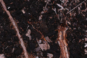
Peat is partially decayed, dead vegetation that has accumulated over thousands of years. Though peatlands are generally saturated with water and difficult to set ablaze, they can become tinderboxes when they are drained to make way for agricultural plantations like pulp and paper and palm oil.
When peatlands burn, huge amounts of CO2 are released.
Although peatlands cover just 3-5 percent of the Earth’s surface, they store more than 30 percent of all soil carbon. And while the area of peatland currently classified as drained and degrading covers less than 0.4 percent of the global land surface, it is responsible for 5 percent of global anthropogenic emissions, according to the United Nations Environment Programme (UNEP).
INDONESIA’S PEAT PROBLEM

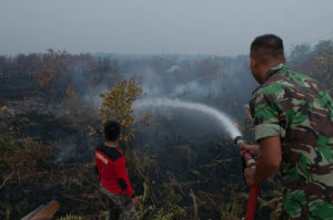
Fires in forests and former forestlands occur in Indonesia in the dry season every year – particularly in the provinces of Riau and Jambi on the island of Sumatra, and West Kalimantan and Central Kalimantan on the island of Borneo.
However, the haze that spreads to other countries is no longer restricted to drought years, and has become increasingly frequent due to ongoing deforestation of peatlands in Indonesia.
The 2015 forest fires in Indonesia were devastating for the environment, resulting in 884 million tons of carbon dioxide being released in the region – with 97 percent originating from burning in Indonesia. The corresponding carbon emissions were 289 million tons, with 1.2 billion tons of associated carbon dioxide-equivalent emissions.
The gravity of this environmental crisis motivated Indonesia’s President Joko Widodo to pledge to restore two million hectares of the country’s degraded peatlands by 2020 to prevent future fires.
Under the CGIAR Research Program on Forests, Trees and Agroforestry, CIFOR is studying the complex socioeconomic, ecological and governance factors at play in peatland restoration, as well as directly engaging with communities on the ground in Dompas village, Riau province, Sumatra.
A NEW GLOBAL PEAT INITIATIVE

Policymakers at COP22 are now looking more closely at how peatlands can be better managed in order to curb carbon emissions. While the launch of the peatland hotspots map at COP21 in Paris last year marked the start of work to develop an online Global Peatland Atlas, more work needs to be done.
For one, there is a need for better mapping before restoration and conservation can begin in some areas. Additionally, new partners will need to be mobilized to make real progress towards sustainable peatland management. In an effort to achieve this goal, the United Nations Environment Programme (UNEP) is set to unveil its new initiative at the Global Landscapes Forum on 16 November in Marrakesh, Morocco.
The Global Peatlands Initiative aims to increase the conservation, restoration and sustainable management of peatlands in countries with significant peat deposits delivering benefits for agriculture, biodiversity and the climate. In terms of scale and scope, the initiative goes beyond any recent collaborative efforts on peat.
Among its founding members are: the governments of Indonesia, Peru and the Republic of Congo, UNEP, FAO, IFAD, the EC, Wetlands International, UNEP-WCMC, GRID-Arendal, Ramsar Secretariat, European Space Agency, WRI, Greifswald Mire Centre and SarVision/Sateligence.


