This article is a longform, part of a new series of FTA blogs aiming at providing in-depth analysis of mature FTA projects. By consulting/interviewing all the scientists involved in the study, these longforms give a detailed overview of specific projects, augmented by the comments from the scientists who developed them. This longform is issued in conjunction with International Mother Earth Day 2020.
A peculiar perspective on the first reports from the pioneering Sentinel Landscapes program
We are living in the Anthropocene.
Sometime in the 1950s, it is proposed, we finally broke from 11,650 years of history and entered a entirely new epoch. Rather than glacial advance and retreat, this epoch is defined by the industrial activity of humankind.
Deforestation, soil erosion, construction, river dams and nuclear weapons will leave permanent relics in the stratigraphy of the earth: as deposits in the sedimentary record, as ghostly technofossils, or as lethal fallout signatures.
Due to human activity, global rates of extinction are perhaps 100-1000 times above the normal background rate. At the same time, invasive species introduced or unwittingly spread by humans are homogenizing global ecosystems. Claims of a sixth major extinction event are not exaggerated and the cause, most scientists agree, is human.
Fossil fuels and land use changes have led to a precipitous rise in atmospheric carbon dioxide levels. The oceans are acidifying; the polar ice caps are melting; the consequences are daunting.
There are two possible responses – if we rule out burying our heads in the degraded soil – either we wait for nature to overthrow industry or we apply our human ingenuity, so often the curse of ecological wellbeing, to its restoration.
But how can we hope to turn things around if we do not know what is driving deforestation and degradation? Or if we do not know how many trees we have or how quickly they are disappearing? Or if we do not fully understand the consequences we face if forests disappear from the landscape?
To develop interventions that will work, the first step is knowing what is going on there, and for this we need data, credible data, large data, multi-year data.
Medical research has epidemiological studies that monitor large cohorts of the population over long periods of time to track global health and help predict and eliminate disease. What does forest conservation have? Sentinel Landscapes.
Sentinel Landscapes: A health check for tropical land use
Driven by the Forests, Trees and Agroforestry’s (FTA) program led by the Center for International Forestry Research (CIFOR), the Sentinel Landscapes initiative is an audacious commitment to collect data on biophysical, social, economic and political dimensions across and monitor respective indicators across a network of eight carefully chosen tropical forest landscapes over extended periods of time.
Using the same standardized methodologies, this data promises to provide common ground for comparison – and, crucially, extrapolation. The Sentinel Landscapes program is the global health check that we desperately need so that we can face climate change, land degradation, poverty and food security with clear vision.
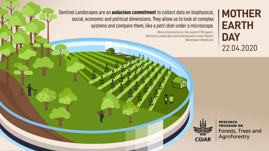
The idea for Sentinel Landscapes was hatched during conversations between colleagues at World Agroforestry (ICRAF) and CIFOR in 2011 and 2012. Since those first conversations, more and more academic organizations have joined the FTA program and participated to the Sentinel landscapes initiative, including Agricultural Research for Development (CIRAD), Bioversity International, Centro Agronómico Tropical de Investigación y Enseñanza (CATIE) and the International Center for Tropical Agriculture. In the words of one scientist, it has always been “super collaborative”.
Sentinel Landscapes have now been established across borders in Borneo-Sumatra, the Nile-Congo, Cameroon, the Mekong, West Africa, Western Ghats in India and the Western Amazon. But the first to report, in February 2020, was the Sentinel Landscape of Nicaragua-Honduras.
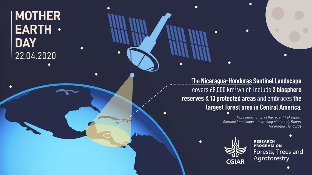
The Nicaragua-Honduras Sentinel Landscape
The NHSL is a “mosaic of forests, agricultural land, cattle ranches and agroforestry systems” covering an area the size of the Republic of Ireland or twice the size of the Netherlands.
Straddling the border of two countries, the NHSL encompasses the largest remaining forest area in Central America and hosts at least twelve different ecosystems, including cloud forest, premontane humid tropical forest and pine savannahs.
According to the new report, as well as astonishing botanical and fauna diversity, the landscapes of the NHSL also sustain 822,175 farm families and 21,000 indigenous peoples.
Different kind of “forest transitions” do take place in the area, representing different situations along the “forest transition curve” concept coined by FTA.
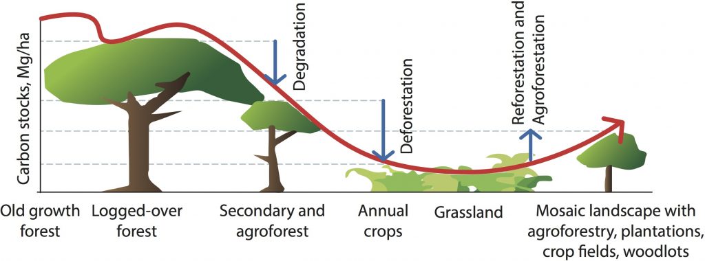
Nicaragua is currently plummeting down the “forest transition” curve, with forest cover being lost at an increasingly rapid rate. Meanwhile, Honduras is a late-transition country, with deforestation slowing in whatever small fraction of forests remain.
It would be impossible to survey such a vast territory in its entirety, so as part of the Sentinel Landscapes (SL) monitoring sampling methodology, the NHSL team selected four study blocks, two in Nicaragua and two in Honduras, which each represent different points on the forest transition curve. Each block is 100 sq km.
The concept of the SL was to integrate three different standardized methodologies to collect:
- biophysical data
- political and institutional data and
- socio-economic data.
These harmonized data collection modules were coordinated by the Research Methods Group (RMG) at ICRAF. The work on biophysical methods began in West Africa in 2005, with the research of Tor-Gunnar Vågen of ICRAF
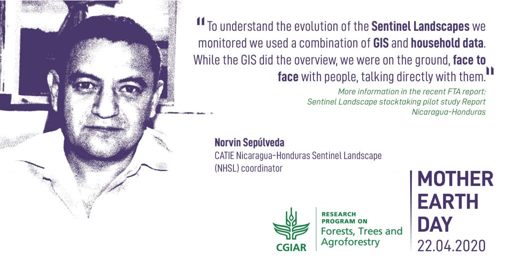
“We chose the four sites using GIS data and a special set of criteria,” Sepúlveda explains, “so that we got a range of different sites and a combination of diverse farm typologies and conservation issues.”
In Nicaragua, the El Tuma La Dalia study block is mountainous terrain, largely cultivated with coffee, but with some pine and cloud forests. Also in Nicaragua, Columbus Mine is less cultivated with staple cereal crops, but has more forest and is known for its tropical humid climate.
Across the border in Honduras, Rio Platáno is primarily forest with little cultivation, whereas the Rio Blanco study block, nestled in a valley, is mostly pasture for livestock with only small pockets of surviving forest.
Beyond case studies: the Land Degradation Surveillance Framework
Tor-Gunnar Vågen is now head of the GeoScience lab at ICRAF, based in Nairobi, Kenya. For the past fifteen years, Vågen and soil systems scientist Leigh Ann Winowiecki, have worked to implement the Land Degradation Surveillance Framework (LDSF).
A systematic method for collecting data and measuring land degradation, the LDSF builds up a biophysical baseline that covers key indicators including land use, land cover, land degradation, soil health, topography and impact on habitat..
But the real strength of the LDSF is in its consistency: it can be applied to any landscape and will give standardized and thus comparable data.
Before the LDSF, most forest conservation data was based on case studies that answered a specific question in a specific location. Although very useful, case study data makes it impossible to compare contexts or to generalize, and impossible to answer questions like ‘What role do trees have on farms in different locations and contexts?’ or ‘What is the potential for soil to sequester carbon in different locations and contexts?’
As a standardized, randomized data collection method, the LDSF solves this problem and helps scientists compare and scale up their localized findings into potentially globally-applicable conclusions.
“Applying the same framework and then replicating this across most major ecosystems means we can start answering the bigger questions,” Vågen says. “We can look at the larger patterns.”
At the start of the Sentinel Landscapes program in 2012, Vågen and Winowiecki trained the local field teams in Nicaragua and in Honduras so that data collection would be consistent.
Tracking degradation and climate change
From the biophysical baseline indicators, Sepúlveda, Vågen, Winowiecki and their fellow authors expect the NHSL to suffer badly from the impacts of climate change, particularly when it comes to the flow and contamination of the water supply.
The geographical location of Nicaragua and Honduras make both countries vulnerable to extreme weather events and a pattern of freak rainstorms alternating with withering drought is becoming more common.
In late 2007, Hurricane Felix destroyed almost 510,764 ha of forest in northeastern Nicaragua – that’s an area four times the size of New York City.
Of course, it is not only Nicaragua-Honduras that faces the challenges of climate change. The eight Sentinel Landscapes scattered across the tropics are critical for monitoring the progress of climate change with a consistent methodology, over long time periods.
But seeing climate change impacts is irrelevant if not looked through the lenses of land-use and land-use change impacts. Although the forest is now in recovery, the NHSL report found that slash and burn agriculture and livestock are encroaching on former forest landscapes.
“One thing that isn’t looked at enough is the interaction between climate change and land degradation,” Vågen says. “When we started out, the focus was more on land degradation per se: soil erosion, loss of soil function and the reduction in soil quality due to land-use change. But of course this data has many other applications and understanding the impacts of climate change is one of them.”
The data, published in the FTA Sentinel Landscapes portal, warn that vulnerable ecosystems may collapse in mere decades once they hit a tipping point of human-induced degradation, combined with the impacts of climate change.
“The ability of a landscape to adapt to changes in climate is affected by land degradation and, of course, degraded land can contribute to emissions.”
The Sentinel Landscapes program tracks this degradation, but the data also points to solutions.
Sentinel solutions: Soil organic carbon
The Sentinel Landscapes data offers remarkable insights into where governments, municipalities and farmers can optimize their landscapes from multiple perspectives, including carbon capture and protection from erosion, and the potential for virtuous circles.
“For example, we see higher tree densities in non-eroded soil,” Winowiecki says, “and higher soil organic carbon in non-eroded landscapes.”

Most people know that forests can act as carbon sinks, but of the total carbon found in terrestrial ecosystems nearly 80 percent is actually stored in the soil. Soil carbon reservoirs are also at risk, and the team has published widely on the link between land degradation and soil organic carbon.
Furthermore, Rattan Lal, director of Ohio State University’s Carbon Management and Sequestration Center, estimates that, with cultivation, the world’s soil has lost up to 70 percent of its original carbon stock. If researchers could find a way to maximize soil organic carbon sequestration, then that would be a significant blow in our Herculean labor to reduce the amount of carbon dioxide in the atmosphere.
According to the new report, soil organic carbon levels are low across all four of the NHSL study blocks. Even small increases in soil organic carbon, when multiplied over large areas, would make a measurable difference – as well as increasing overall soil quality.
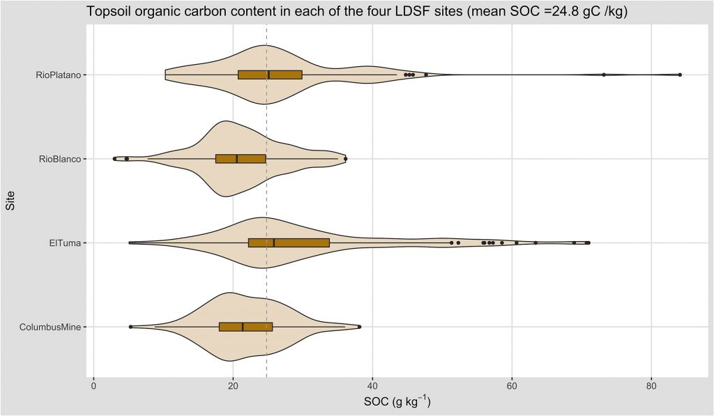
“One of the things we’re able to do now is map soil organic carbon over very large areas and look at the potential for storage of carbon in the soil,” Vågen explains.
Combining field data collected with the LDSF and remote sensing imagery from satellite, Vågen and his team are able to produce maps of key soil and land health indicators at a scale relevant to farmers and decision makers, for example at 30 meter resolution, with high accuracy (using the Landsat satellite imagery, the resolution is 30 meter squared).
“We can say what the trends are and what the potential is to store carbon in the soil,” Vågen says. “And we can do that down to the level of individual farmers.”
Of course, this information, however precise, would mean nothing at all unless the farmers could do something about it.
Winowiecki, a specialist in soil organic carbon, has good news: “With good land and landscape management we can increase soil organic carbon,” she says. “But the data shows wide variation, even within one site, so it’s important that we tailor the management to each specific farm.”
It sounds like a lot of work, but it should come as no surprise that there is no “one size fits all” solution.
“We talk a lot about ‘Options by context’,” Winowiecki says. “That means developing local options for the local context.”
Different areas can vary enormously, not only by physical environment, but also by local governance and even household structure. These factors go beyond the LDSF method and the second strand of the Sentinel Landscape approach is a socio-economic survey that attempts to capture the wider context in which the landscape is embedded.
“For any intervention to work,” Winowiecki says, “you have to understand the context and that’s exactly what the Sentinel Landscapes have done.”
Context is everything
The socio-economic surveys was every bit as impressive an undertaking as the biophysical baseline study of the LDSF. The development of the socio-economic methodology and design of the household module was coordinated by Anja Gassner, while the subsequent analysis of data generated for all the landscapes was led by Brian Chiputwa (both with the Research Methods Groups at ICRAF) in consultation with CATIE.
The socio-economic surveys were designed to capture baseline information on households’ production systems, livelihood portfolios, asset endowment and use of natural resources such as forests. This data was then used to construct various indicators that can be used as proxies for household’s dependency on natural resources (land, water and forests), food security and nutrition and poverty status. These indicators can provide important insights into household economic activities.
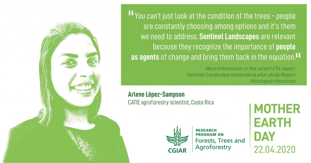
Based in Costa Rica, CATIE agroforestry scientist Arlene López-Sampson helped analyze the reams of NHSL data. “You can’t just look at the condition of the trees and ignore the people,” López-Sampson says, “because they are constantly choosing among options and it’s them we need to address. Sentinel Landscapes are relevant because they recognize the importance of people as agents of change and bring them back into the equation.”
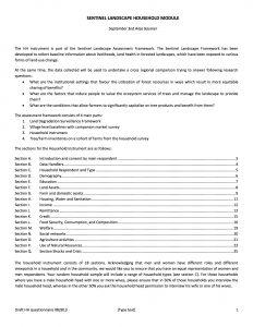
“There are a lot of people involved and we need the trust of the local municipalities and grassroots organizations,” López-Sampson says. “It’s very context dependent. What’s happening in Nicaragua is different to what’s happening in Honduras and to what’s happening in other parts of the world.”
Norvin Sepúlveda coordinated the field teams in Nicaragua and Honduras: “A combination of GIS and household data is very important to give us a better idea of what is happening,” he says. “While the GIS did the overview, we were face to face with the people, taking information directly from them.”
Sepúlveda gives a good example of how the dual approach works. “In one area, the GIS showed patches of forest left,” he says. “So we went to the household to find out why: it was to protect the water supply.”
Trees act like giant sponges, collecting and filtering rainwater before releasing it gradually into streams and rivers. Take away the trees and you get flash floods, soil erosion and a sharp reduction in water quality.
“It’s very important for us to find out why forest is left standing,” Sepúlveda says. “It often depends on a farmer’s education, on the state of his land, and on whether he has legal rights to the land.”
And so we come to the thorniest issue faced by the NHSL team: conflict and governance.
Within the socio-economic surveys, the institutional mapping and natural resource governance activities were implemented using the International Forestry Resources and Institutions (IFRI) methodology, developed by Scientists at the University of Michigan, USA.
“The one big challenge”
“The major challenge of the whole project was operating in the border,” Sepúlveda says. “Lack of governance there is the one big challenge.”
“In Nicaragua, El Tuma La Dalia is doing well with restoration, earning some extra money for coffee farmers,” Sepúlveda explains. “But at Columbus Mine, the deforestation has been very bad.”
Columbus Mine is the home of the Tasba-Pry indigenous group and, according to the report, their practice of communal land ownership, although recognized by the government, is coming into conflict with the growing population of settlers who pursue private ownership.
It is a similarly mixed story in Honduras: “At Rio Platáno they are approaching forest management, which is good,” Sepúlveda says. “But in Rio Blanco livestock is taking down all the forest that is left.”
Rio Platáno is home to several different indigenous groups, whose land rights have not been recognized by the government. As a result, the NHSL study reports, they have fallen victim to land grabs.
“We also have problems there with drug trafficking,” López-Sampson says. “It’s really hard to work in that kind of geography because it’s not only about land management; it’s also about organized criminal activities.”
But of course these kinds of challenges are not unique to the NHSL and researchers must understand the whole picture in order to change behaviors.
“We chose a combination of both different contexts and people,” Sepúlveda explains. “It makes for a contrast to the other agricultural sites, which are more stable.”
Sentinel solutions: Making change happen
The Sentinel Landscapes program is a breathtaking display of the research possible when scientists from different disciplines collaborate at every scale, from collecting soil samples on the ground to capturing remote sensing data from space to conducting focus group discussions with farmers or interviewing individual farmers on their farms.

“We need a lot of people to do our work,” López-Sampson says. “The coordination of knowledge is really important: between academics, but also among the local organizations who are doing all the interventions we try to promote so that we all have healthy ecosystems.”
The team hopes that the work they have done in the NHSL can help Honduras move further up that forest transition curve and encourage Nicaragua to bottom out their deforestation sooner rather than later.
“Trees are now part of the agenda,” López-Sampson says. “Trees are now seen as important to have on the farms, not only to provide timber, but as part of local community strategies to provide incomes and help maintain a healthy ecosystem by providing a link between the landscape and the agroforestry system.”
Meanwhile, Vågen is ambitious about the future: “Using LDSF we can accurately track changes over time and create bespoke interventions for specific plots and specific farmers to maximize land conservation, biodiversity and soil organic carbon capture.”
It is clear that the long term monitoring of the Sentinel Landscapes approach is absolutely necessary to bring clarity to the slow processes of landscape management and climate change.
“Five, ten years isn’t long enough,” Sepúlveda concludes. “I really hope these projects carry on, in order to see restoration, in order to see people change their minds and in order to see the new generations make change happen.”
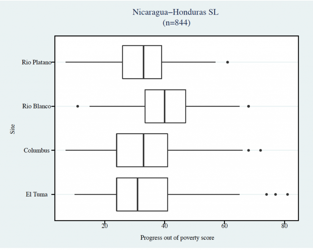
The ultimate goal of the Sentinel Landscapes approach is to build up on these diverse data over longer periods and be able to integrate the socio-economic, biophysical and political indicators. For example, with long-term data, it will be interesting to map out causal links between household poverty levels (see diagram below) and land degradation over time in the four sites; and how these vary through different governance structures across communities.
The Economist recently published an interesting report in 2017 titled “The world’s most valuable resource is no longer oil, but data”. With adequate investment and if collected in a dynamic, responsive and consistent way, big data approaches that monitor and integrate indicators from diverse disciplines such as the natural and social sciences, can lead to more complete and actionable set of insights for better adaption and mitigation strategies against climate change. Initiatives such as the SL could well be the next oil in future.
“A warning shot”: Sentinel Landscapes research and Coronavirus
At the time this article was written, all the NHSL scientists were already all working from home (be it in Costa Rica, Nicaragua or Kenya), in a global attempt to slow the transmission of coronavirus. “Our heavy reliance on industrial agriculture, with large, uniform herds, makes us vulnerable to outbreaks,” Vågen says. “The information we can provide, such as landscape diversity, could be a valuable contribution down the road.”
As animals and people are forced into closer proximity either in landscapes because wildlife habitats are anthropized, or through wild food markets, the probability of a virus making the leap to humans increases.
Vågen warns that ecological degradation makes diseases such as Covid-19 much more likely and, in our hyper-connected world, we need to start paying closer attention.
“It’s one of those up and coming things that we need to be looking at,” Vågen says. “And not just coronavirus, but other diseases,” he adds. “For me, it’s a warning shot. It’s something that we need to understand better, how it relates to the state of our planet in general.”
In times past, sentinels were flesh and blood watchers responsible at all hours to warn their kinsfolk of any approaching existential threat – whether wild beast, enemy army, fire or plague.
Today, our most valuable sentinels are scientific: the ice core samples that warn us of global heating; the remote sensing data that warn us of deforestation.
The Covid-19 outbreak shows what can happen when we have no sentinels – or, worse, when we ignore them. Without sufficient, credible warning, our society becomes extremely vulnerable to unseen existential threats.
The United Nations has sworn to dedicate the coming decade to halting ecosystem degradation and restoring already degraded ecosystems. But if science is to guide us safely through the Anthropocene, then we need to support our scientific watchers through continuous monitoring programs like Sentinel Landscapes.
More crucially, we need to listen.
By David Charles. This article was produced by the CGIAR Research Program on Forests, Trees and Agroforestry (FTA). FTA is the world’s largest research for development program to enhance the role of forests, trees and agroforestry in sustainable development and food security and to address climate change. CIFOR leads FTA in partnership with Bioversity International, CATIE, CIRAD, INBAR, ICRAF and TBI. FTA’s work is supported by the CGIAR Trust Fund.
Selected references
Chiputwa, B., Ihli, H.J., Wainaina, P., Gassner, A., 2020. Accounting for the invisible value of trees on farms through valuation of ecosystem services, in: Rusinamhodzi, L. (Ed.), The Role of Ecosystem Services in Sustainable Food Systems. Elsevier Inc., pp. 229–261. https://doi.org/10.1016/B978-0-12-816436-5.00012-3
Chiputwa, B. 2016. An exploratory guide on constructing socioeconomic indicators for the Sentinel Landscape Project: The case of the Nicaragua-Honduras Sentinel Landscape. Nairobi, Kenya: World Agroforestry Centre (ICRAF), 56 p. https://drive.google.com/file/d/0B8GL6bTxo5ekMXRzN003ck1hV1E/view
Chiputwa, B., Spielman, D.J., Qaim, M., 2015. Food Standards, Certification, and Poverty among Coffee Farmers in Uganda, World Development Vol. 66, pp. 400–412. https://www.sciencedirect.com/science/article/pii/S0305750X1400271X
Coulibaly, J.Y., Chiputwa, B., Nakelse, T., Kundhlande, G., 2017. Adoption of agroforestry and the impact on household food security among farmers in Malawi. Agric. Syst. 155, 52–69. https://www.sciencedirect.com/science/article/abs/pii/S0308521X17303001
FTA, 2011. CGIAR Research Program 6 – Forests, Trees and Agroforestry: Livelihoods, Landscapes and Governance Proposal. Document available here
Pramova, E.; Lavorel, S.; Locatelli, B.; Colloff, M.J.; Bruley, E. 2020. Adaptation in the Anthropocene: How we can support ecosystems to enable our response to change, CIFOR. https://doi.org/10.17528/cifor/007588
Sepúlveda N, Vågen T-G, Winowiecki LA, Ordoñez J, Chiputwa B, Makui P, Somarriba E and López-Sampson, A. 2020. Sentinel Landscape stocktaking pilot study: Report Nicaragua-Honduras. Working Paper 2. Bogor, Indonesia: The CGIAR Research Program on Forests, Trees and Agroforestry (FTA). https://doi.org/10.17528/cifor/007537
Vågen, T.-G.; Winowiecki, L.A. Predicting the Spatial Distribution and Severity of Soil Erosion in the Global Tropics using Satellite Remote Sensing. Remote Sens. 2019, 11, 1800. https://www.mdpi.com/2072-4292/11/15/1800
Vågen, Tor-G., Winowiecki, L., Tondoh, J.E., Desta, L.T. and Gumbricht, T. 2016. Mapping of soil properties and land degradation risk in Africa using MODIS reflectance. Geoderma. http://dx.doi.org/10.1016/j.geoderma.2015.06.023
Winowiecki, L., Vågen, T-G. and Huising, J. 2016. Effects of land cover on ecosystem services in Tanzania: A spatial assessment of soil organic carbon. Geoderma. (http://www.sciencedirect.com/science/article/pii/S0016706115000816)
Vågen, T-G and Winowiecki, L. 2013. Mapping of soil organic carbon stocks for spatially explicit assessments of climate change mitigation potential. Environmental Research Letters. 8. http://dx.doi.org/10.1088/1748-9326/8/1/015011


